


Voting District 51135, Santa Cruz County, California
About
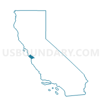
Outline

Summary
| Unique Area Identifier | 544008 |
| Name | Voting District 51135 |
| County | Santa Cruz County |
| State | California |
| Area (square miles) | 22.33 |
| Land Area (square miles) | 22.33 |
| Water Area (square miles) | 0.00 |
| % of Land Area | 99.99 |
| % of Water Area | 0.01 |
| Latitude of the Internal Point | 37.19762830 |
| Longtitude of the Internal Point | -122.07373360 |
Maps


Graphs
Select a template below for downloading or customizing gragh for Voting District 51135, Santa Cruz County, California


Neighbors
Neighoring Voting District (by Name) Neighboring Voting District on the Map
- Voting District 10160, Santa Clara County, CA
- Voting District 10165, Santa Clara County, CA
- Voting District 10390, Santa Clara County, CA
- Voting District 30440, San Mateo County, CA
- Voting District 51140, Santa Cruz County, CA
- Voting District 51165, Santa Cruz County, CA
- Voting District 51180, Santa Cruz County, CA
- Voting District 51225, Santa Cruz County, CA
- Voting District 51395, Santa Cruz County, CA
- Voting District 51460, Santa Cruz County, CA
- Voting District 53000, Santa Clara County, CA
- Voting District 53090, Santa Clara County, CA
- Voting District 53100, Santa Clara County, CA
Top 10 Neighboring County Subdivision (by Population) Neighboring County Subdivision on the Map
- Half Moon Bay CCD, San Mateo County, CA (28,894)
- San Lorenzo Valley CCD, Santa Cruz County, CA (23,195)
- West Santa Clara CCD, Santa Clara County, CA (7,529)
- Lexington Hills CCD, Santa Clara County, CA (4,009)
Top 10 Neighboring Place (by Population) Neighboring Place on the Map
Top 10 Neighboring Elementary School District (by Population) Neighboring Elementary School District on the Map
- Cupertino Union Elementary School District, CA (138,600)
- Los Gatos Union Elementary School District, CA (27,174)
- Saratoga Union Elementary School District, CA (19,679)
- Lakeside Joint Elementary School District, CA (2,632)
Top 10 Neighboring Secondary School District (by Population) Neighboring Secondary School District on the Map
- Fremont Union High School District, CA (223,745)
- Los Gatos-Saratoga Joint Union School District, CA (53,209)
Top 10 Neighboring Unified School District (by Population) Neighboring Unified School District on the Map
- San Lorenzo Valley Unified School District, CA (23,877)
- Scotts Valley Unified School District, CA (17,660)
- La Honda-Pescadero Unified School District, CA (3,464)
Top 10 Neighboring State Legislative District Lower Chamber (by Population) Neighboring State Legislative District Lower Chamber on the Map
- Assembly District 19, CA (433,645)
- Assembly District 21, CA (432,366)
- Assembly District 27, CA (424,862)
Top 10 Neighboring State Legislative District Upper Chamber (by Population) Neighboring State Legislative District Upper Chamber on the Map
Top 10 Neighboring 111th Congressional District (by Population) Neighboring 111th Congressional District on the Map
Top 10 Neighboring Census Tract (by Population) Neighboring Census Tract on the Map
- Census Tract 1205, Santa Cruz County, CA (5,687)
- Census Tract 1203.01, Santa Cruz County, CA (5,180)
- Census Tract 1206, Santa Cruz County, CA (4,733)
- Census Tract 5118, Santa Clara County, CA (4,009)
- Census Tract 6138, San Mateo County, CA (4,005)
- Census Tract 5117.07, Santa Clara County, CA (3,009)
Top 10 Neighboring 5-Digit ZIP Code Tabulation Area (by Population) Neighboring 5-Digit ZIP Code Tabulation Area on the Map
- 95014, CA (60,717)
- 95070, CA (30,617)
- 95033, CA (9,372)
- 95006, CA (8,979)
- 95018, CA (7,778)
- 95005, CA (6,311)
- 94020, CA (1,559)